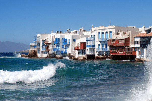
The meltemi is a dry cool wind that tempers the hot summer of Greece for periods of days and endows a blue clear sky and excellent visibility conditions. Usually it is a steady good wind which provides speed and pleasure in sailing holidays. However, in some periods and areas can appear with dangerous force.
The meltemi (pronounced “meltémi”) is a wind that relates exclusively to the Aegean Sea during the summer months from mid-June until September with peak incidence in July and August. The particular characteristics it shows have been studied since the ancient times where these winds were called “etisíes”.
Meltemi force
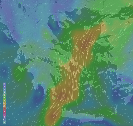
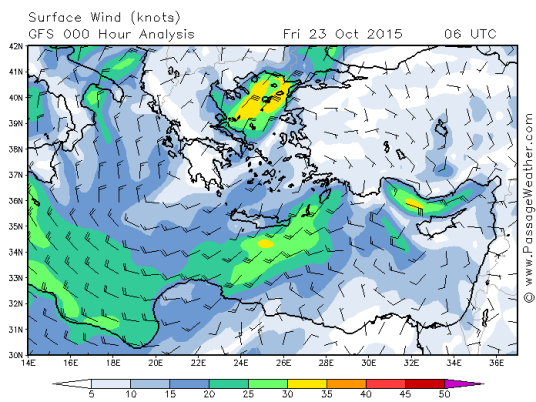
When meltemi blows, the intensity of wind is usually 6 to 7 in Beaufort scale yet sometimes reaches 8 Beaufort even. In June and September the meltemi is usually weaker than that of July and August while to the ends of summer period may not exceed the 4 Beaufort.
The passing of meltemi through sea channels, as for instance between islands, greatly increases its intensity. In general, the intensity of meltemi increases during the hot hours of the day and cuts down at night.
Meltemi direction
The wind direction varies depending on the region of the Aegean Sea. In the northern Aegean it starts blowing from the northeast and continues so down to the central-western Aegean where gradually turns blowing from north direction. The north direction of wind continues so in the southwestern Aegean where it turns again blowing from northeast direction at the sea of Kythera (the strait between Kythera and Crete). In the central-eastern Aegean the meltemi blows from northerly directions reaching up to northwest or even western in the southeastern Aegean. Relatively to the above, Crete receives meltemi from northeast direction in the western regions, from north direction in the central regions and from northwest direction in the eastern regions of.
What causes the start of a meltemi period
The conditions existing so that a meltemi to appear are when there is an area of high pressure over the Black Sea and at the same time a large area of low pressure appears over Southeast Asia where an extension of occupies the northeastern Mediterranean. Where orographic clouds are formed over the mountains of the Aegean Islands, foreshadow strong meltemi. In the summer days where meltemi does not blow the prevailing winds are of southern directions usually. These winds are most of the times light up to dead calm grade. At any rate and depending on their intensity, the whatever prevailing winds are affected by the local thermal phenomena related to the morphology and geographic location of each particular region.
The origin of word meltemi
There are many words that Greek sailors use through their long maritime tradition the etymological origin of which is unknown. One of them is the word meltemi. It is very likely to originate from a corruption of the Italian words “mal & tempo” which mean bad weather. It is usual for the Greek seamen to adopt a word that is often said by foreign speaking sailors or in foreign ports, which through corrupting they fit to the necessity of being clearly heard among noises or in windy conditions. This has happened with some Italian words in the middle ages onwards. From 1900 on, there has been the same with English words. However the origin of the word meltemi can even be pre-Homeric as the skillful seafarers of that era had already formed their unofficial maritime vocabulary. The corresponding word used in writings of the classical era is “etisíes”, meaning annual, which sounds rather like a word that fits in the scientific explanation of the phenomenon rather than a word that aspires to be heard clearly in windy conditions.
Further reading:


